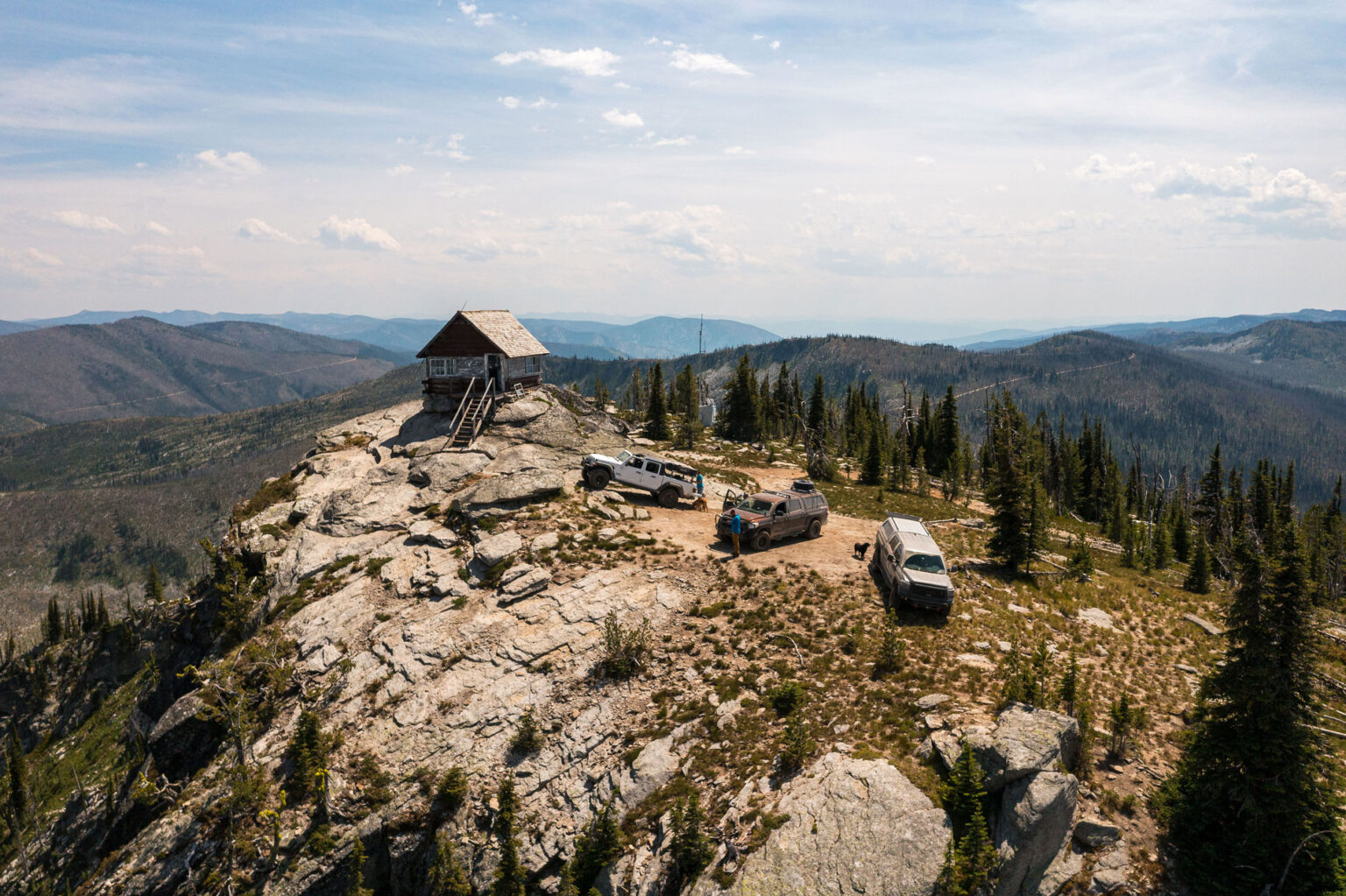
Some of my earliest memories outdoors with my family were created deep in the mountains in one of the Toyota Land Cruisers that my dad had built for rock crawling. Those motorized adventures introduced me to what is known today as overlanding and fueled my love of camping and off-roading.
As I grew older, my passions expanded, and I took up more human-powered pastimes to get into nature; things like kayaking, climbing and mountain biking. However, I have never lost my appetite for the powersports world and still regularly use those modes of transportation to access some of the most remote areas of the Inland Northwest.
In fact, I purpose-built my truck to be a good balance between off-road capability and comfort while also being a daily driver and grocery-getter. My love of off-roading and my passion for the outdoors has culminated in a yearly late spring-into-summertime tradition with a few of my friends. We try to give back to the local offroad community by attempting to open up and clear various sections of the Idaho Backcountry Discovery Route (BDR); we bust through lingering snow drifts, and most importantly, clear the trees that have fallen down over the course of the winter. We love the challenge of it, and there is, of course, a little bit of healthy competition trying to be the first people through a section for the year.
The Idaho BDR is a 1,250-mile mostly off-road adventure, running through the most rugged, remote, and scenic parts of the state. Officially, the route starts in the south at Jarbidge, Nevada and runs north all the way to the Canadian border above Bonners Ferry. Many people ride north to south as well, depending on where they live or if they plan on connecting to another BDR in another state. Many others, like me and my friends, pick and choose sections in an effort to navigate our life-play-work balance.
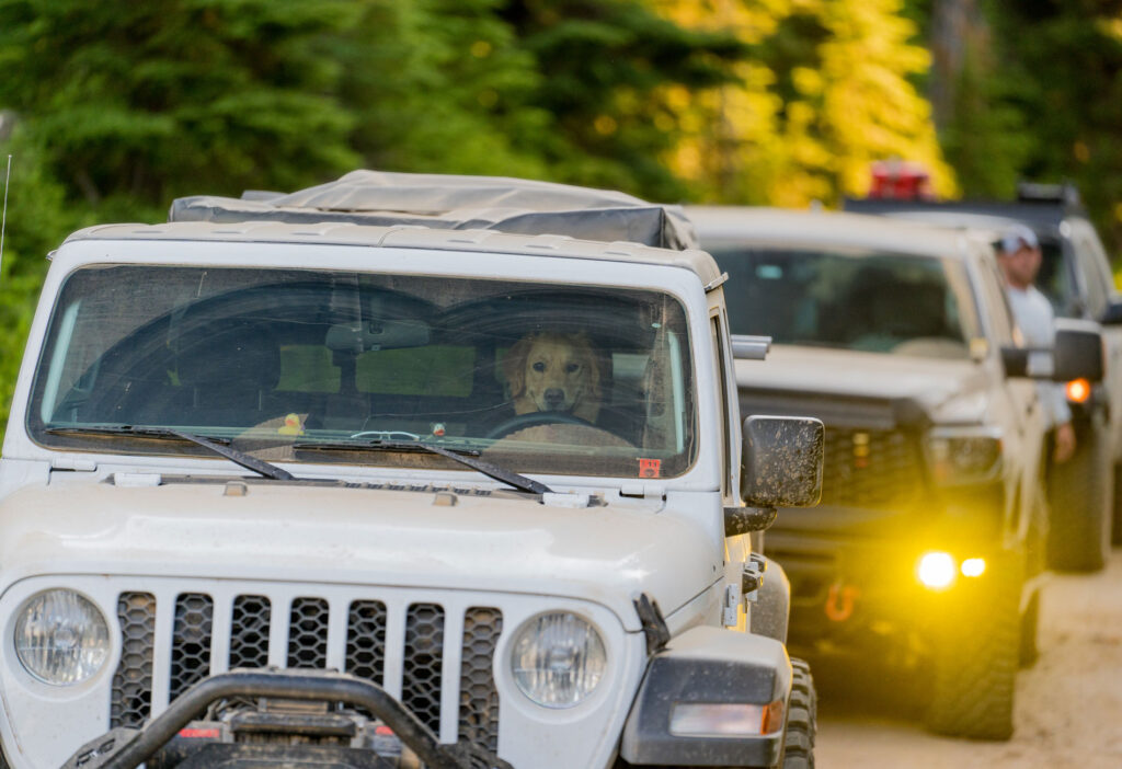
Bryan Myers’ dog, Holly, anxiously awaits his return while the guys were stopped and clearing a tree from the roadway.
>> Setting the course
This trip was several months in the making last year. There would be four trucks and six friends driving three sections of the BDR over three days; quite a bit longer than our usual spontaneous day trips to cut trees out of the roadway. Ultimately, it would end up being more than 800 miles round trip with more than 600 of those miles driven off road. Jeff Durocher, Steve Duranceau and I would ride in my Tundra. Bryan Myers would drive his Gladiator. Ken Ebner would take his Tundra and Greg Barker would drive his Sequoia.
We met up at 5 a.m. on a Friday morning. The sun was just beginning rise as we organized gear into the trucks and got situated for a long first day. We had to complete 197 miles of remote dirt roads the first day, beginning along the I-90 corridor near Taft on a variation of the BDR we designed ourselves.
As soon as we left interstate 90, a few miles over the state line into Montana, we were on dirt. We pulled over into the Hiawatha Trailhead parking lot and began the 10- to 15-minute process of airing our tires down to increase traction, improve ride quality and decrease wear and tear on the trucks.
While the continuous hissing sound of air escaping the tires drowned out the sound of the birds and bugs humming and chirping in the surrounding forest, we chatted about the game plan for the day. We had multiple mountain passes to cover (all in all we ascended and descended over 75,000 vertical feet that day) and several long sections of road that none of us were familiar with outside of scouting using satellite imagery.
Despite having radio communication, we all agreed the lead truck would stop and wait at any intersection to ensure no one made a wrong turn trying to follow in what would be epic proportions of moon dust. Getting lost in these mountains would be less than ideal. Radio communication with low-power two-way radios is only good for maybe a couple of miles in the deep canyons and steep passes we would be driving.
>> Hitting the road
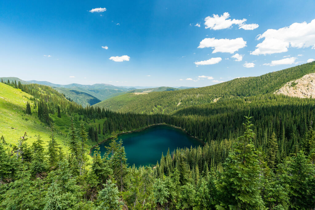
Part of the first leg of the trip had us traversing the very northern end of the Bitterroot Mountains down to the North Fork of the Clearwater and out to the town of Pierce, Idaho. Along the way, we drove along a narrow ridgeline and by at least six alpine lakes nestled between magnificent, craggy peaks. We traversed our way south and eventually made our way down to the Shadowy St. Joe River. We then continued upstream towards its headwaters for the next couple of hours. Driving along the inviting emerald green waters, it was impossible not to share fly fishing stories.
We made it to the top of our final major pass of the day between the St. Joe and North Fork Clearwater drainages and stopped for lunch overlooking a stunning alpine lake. After a quick lunch, we made our way down into the Black Canyon of the North Fork Clearwater. It is a spectacular canyon lined with massive granite spires and old growth cedars. It was difficult to resist the cool water of the river during the oppressive heat of the day. Alas, we knew that we couldn’t stop; we still had many miles to go before making it to our first camp on the famous Lolo Motorway. But first, we needed to get to Pierce for fuel.
The Idaho BDR is not just challenging due to the ruggedness of the roads that it travels over, but also the distances between fuel stops. Several of the sections are around 200 miles with nothing but remote wilderness between the start and stop points.
Finally, we arrived in the little town of Pierce around 6 p.m. that first evening and took turns fueling up at the small gas station and market. The BDR is extremely beneficial to many of the tiny mountain communities that the sections connect. With mining and logging having slowed over the last few decades, it is a welcome economic boost to the small businesses that still exist in these towns. Pierce is no different. There are excellent rustic lodging options as well as a couple of fantastic eateries to visit when in town.
Once we were fueled up, we headed back out of town 30 miles to our first camp, and about 20 miles into the Lolo Motorway. We set up camp just as darkness descended on us. Jeff made steak fajitas and we ate like kings on the edge of an old burn with unbroken views of the skyline over an unimaginably large wilderness ahead of us. We went to bed not long after dinner, knowing that Saturday would be another huge mileage day on much rougher roads, and with the worry that long sections of the road would have downed trees that needed to be cut out.
>> Navigating the unexpected
We woke early with the sunrise; Jeff and I in hammocks, Ken and Greg in tents, and Bryan in his rooftop tent. We noticed some new haze along the horizon and down in the Lochsa River Drainage below. Greg is a career wildland firefighter, and we quickly figured out there were a couple of fresh forest fires we would be skirting around toward the end of our day. With how dry and hot it was, we made sure to keep a close eye on them as we made our way closer to ever-expanding plumes of smoke only a few miles from us.
The Lolo Motorway is a historic passageway that early settlers in the region used to traverse between the Missoula-area and North Central Idaho. It is a much rougher and less-improved road than what we had driven the day before — while we welcomed this, it slowed the pace. We had over 200 miles to drive and needed to arrive at camp at the beginning of the Magruder Corridor by that evening.
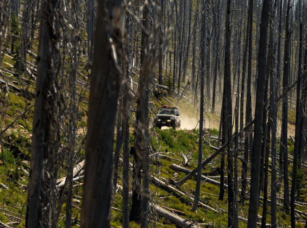
We hadn’t traveled far that morning before we came to a long section of downed trees in the road. Granted, they had been cut to open the road, but with little clearance for a truck to drive through, leaving most of the trees still in the road. This represents risk for traffic. My buddy Jeff Durocher single-handedly spent three days last summer with his chainsaw cutting open the entire Lolo Motorway and removing hundreds of trees. Most of the area that this road travels through burned a few years back. For that reason, dead trees are constantly falling across the road, representing a nearly never-ending project.
We spent a couple hours removing more than 200 trees between the six of us using four chainsaws and a ton of teamwork. We did all of this in only a couple miles of road with at least 60-70 more miles of the Lolo Motorway ahead of us. We finally decided we needed to abandon our cause and only remove hazard trees going forward; ones that posed a severe risk to travelers, particularly BDR riders on adventure motorcycles.
Several hours later, around 4:30 in the afternoon, we emerged from the woods, sweaty and dusty, but with another 80 miles to go for the day. We grabbed a late lunch at the famous Lochsa Lodge, and then headed toward our camp for the night outside of Darby, Mont.
Just as darkness fell, well after 9 p.m., we rolled into a gorgeous meadowy camp with sporadically spaced giant ponderosa pines, a staple of the Bitterroot Mountains. In the distance we could hear the river rushing through the darkness, soon accompanied by the crackling of the fire and the chirping of crickets. Sleep came easily that night.
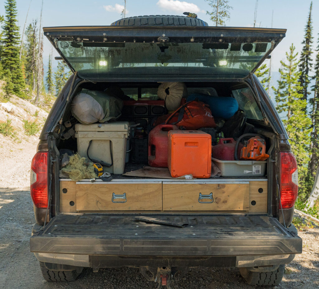
Moondust would end up being one of the primary themes of this summer trip. The dust lingered in the vehicles and on the gear for months afterward.
>> The home stretch
The following morning was filled with a sort of tense excitement. It was our final day; and while we were on the home stretch, it would still be a huge day in terms of mileage. Not only did we have over 160 miles of rough wilderness roads to contend with, but also the hours of highway driving to get back home once we reached “civilization.”
The BDR was certainly not one to disappoint and our final section, the historical and famous Magruder Corridor, was as stunning and impressive as we had hoped.
I heard an interesting take about that section of road recently from an old-timer who said something to the effect of “Those fires that ravaged that Corridor were the best thing to happen to the scenery along that road.”
As we drove along, in utter amazement at the expansive views, I couldn’t help but listen to that tiny voice of agreement. Without the fires, there would have been far fewer views. While that is certainly a controversial take depending on how a person views the natural world, there can be no question that the adventure, the drive, the views and the camaraderie were nothing short of inspirational. N
As seen in the 2024 Summer/Fall edition
By: Chris Celentano


