


Closest city to the trailhead:
Hood River, Ore.
Average Distance of hike:
3.75 miles
Why do you recommend it?
Who wouldn’t like to wander through a stunning temperate forest beneath a large Pacific Ring volcano where the trail ends at a 110-foot tall waterfall? A relatively short and moderately easy 1.875 mile hike meanders through a forest filled with moss, mushrooms, and parallels the rushing, crystal clear waters of Cold Springs Creek.
What was most noteworthy?
After scrambling up through the crux of the hike, an impressive basalt talus field, hikers reach a crest and shortly thereafter are treated to the massive Tamanawas Falls pouring over a sharp edge and free-falling to the rocks below.
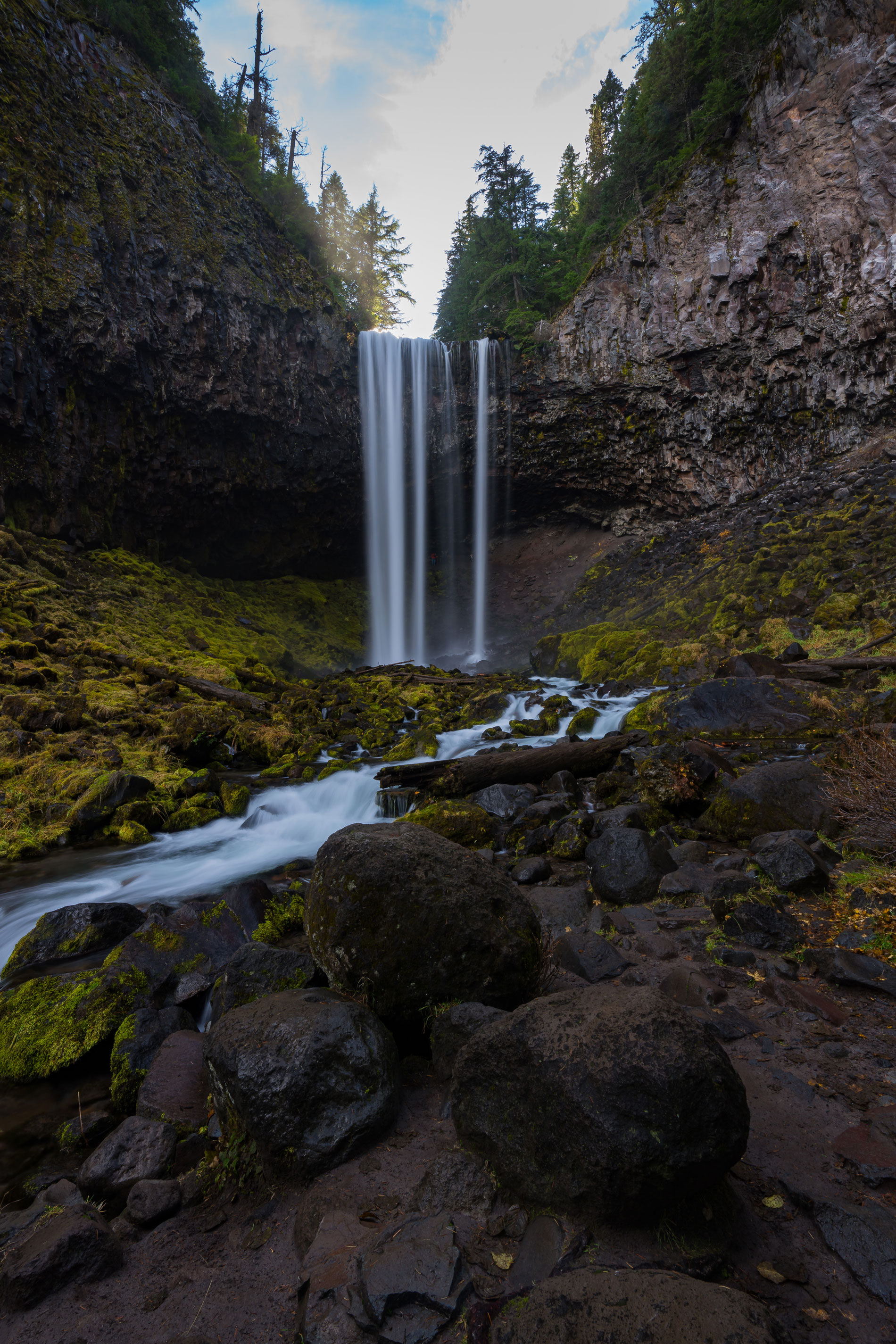
The 110-foot tall Tamanawas Falls at the end of the 1.875 mile trail.
Are there restrooms?
Yes
Know before you go?
While the hike is not particularly difficult, with only 700 feet of elevation gain, there are many places with exposed roots and rocks to negotiate. You will need a Forest Service Day-use access pass to park and hike Tamanawas. Stop at the USFS Range Station, about 8 miles before the trailhead, and use the digital kiosk to purchase a permit.
Where to celebrate after?
Pelican Brewing
How do you get there?
From Hood River: Drive south on Highway 35 approximately 25 miles to the Tamanawas Falls Trailhead. The trailhead is located on the west side of the highway and includes a large gravel pullout. N
Nspire Challenge Rating:
- Lazy Sunday Stroll
- Family Adventure
- Average Outdoor Enthusiast
- Bring Your A-Game
- Master Adventurer
As seen in the 2026 Winter/Spring edition
By: Chris Celentano